


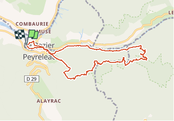


15.4 km | 24 km-effort


User


FREE GPS app for hiking
 SityTrail
IGN / Geographical institutes
SityTrail World
The world is yours!
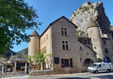
Trail Walking of 10.4 km to be discovered at Occitania, Lozère, Le Rozier. This trail is proposed by Patakk.
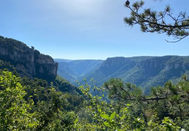
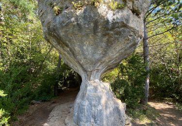
Randonnée magnifique dans la forêt du Causse Noir, avec un point de vue hors du commun depuis l'ermitage St Michel !

Walking
Walking
Walking

Walking
Walking
Walking
Walking
Walking
Walking
très belle rando. bien la faire dans le sens proposé : montée le matin, a l'ombre en sous bois. nombreux passage en sous bois alternant avec des espaces dégagés avec superbes point de vue. suivre le balisage jaune.